|
Title: First a math question, then... Post by: Phinnaeus Gage on January 02, 2013, 03:50:20 AM I read something the other day that got me a thinkin', but I need to verify something first by you math brainiacs here. Afterward, I'll share with you what I've found, über-similar to something discussed a few times here on this forum. But first, the question.
Could the exact GPS coordinates be found if only three other GPS coordinates are supplied along with exact distance from each to the desired location? Or would that give you two possible locations? And if three GPS coordinates would result in two locations, would a minimum of four or more equal only one location? I look forward to the replies. ~Bruno K~ Title: Re: First a math question, then... Post by: payb.tc on January 02, 2013, 03:54:24 AM it would only result in 1 location.
draw the 3 known ones on a map, and then draw a circle around each one; the radius being their distance to the 'unknown' point. where all 3 intersect will be where the buried treasure is. edit: the above assumes either that the world is flat, or that the distance from a known point to the unknown point does not exceed half the earth's circumference (does not wrap around). Title: Re: First a math question, then... Post by: drakahn on January 02, 2013, 03:55:12 AM I'm not a math brainiac...
but knowing three points, if you draw a circle around each point that has a radius equal to the distance from said point, the circles should meet at one spot... "the location" ... but I've been wrong before Title: Re: First a math question, then... Post by: payb.tc on January 02, 2013, 04:00:25 AM woah, i just learned something...
it results in TWO points IF all 3 known points are in a straight line. and it follows that an infinite number of known points will not reduce this to 1 known point as long as all the known points are in a straight line. gotta have some kind of triangle there for triangulation :D Title: Re: First a math question, then... Post by: Third Way on January 02, 2013, 04:01:19 AM Are you trying to triangulate a position on a map, or of a person? You want to share coordinates? looking fo rsomething specifically?
Title: Re: First a math question, then... Post by: K1773R on January 02, 2013, 04:07:00 AM if u have 3 GPS cordinates and u know the distance to each one u can triangulate it, this isnt really hard.
if some GPS atributes (x,y,z) are the same it may happen that there are multiple possible positions. Title: Re: First a math question, then... Post by: Phinnaeus Gage on January 02, 2013, 04:18:48 AM woah, i just learned something... it results in TWO points IF all 3 known points are in a straight line. and it follows that an infinite number of known points will not reduce this to 1 known point as long as all the known points are in a straight line. gotta have some kind of triangle there for triangulation :D That's what I figured. Allow me to be a little more specific. You are holding a device that reads out that you are X miles away from a specific location. No GPS coordinates are given, with this fact being true for all as I continue with my example. You move to another location of which you know the direction and distance, then reread the device. It now states that you are Y miles from that same specific location. Either from the new location or the original one, you once again relocate to another point, also knowing how far and what direction you traveled. Looking at the device, you now see that you are Z distance from the specific location desired. Given that, can you triangular where the desired specific location is by one result, or is there a second result that also must be checked? Assume the distance is in a straight line as a crow flies. Thanks to all who've answered so far. ~Bruno K~ Title: Re: First a math question, then... Post by: Phinnaeus Gage on January 02, 2013, 04:21:36 AM Are you trying to triangulate a position on a map, or of a person? You want to share coordinates? looking fo rsomething specifically? I'll get to that shortly, TW. Title: Re: First a math question, then... Post by: myrkul on January 02, 2013, 04:58:32 AM You are holding a device that reads out that you are X miles away from a specific location. No GPS coordinates are given, with this fact being true for all as I continue with my example. You move to another location of which you know the direction and distance, then reread the device. It now states that you are Y miles from that same specific location. Either from the new location or the original one, you once again relocate to another point, also knowing how far and what direction you traveled. Looking at the device, you now see that you are Z distance from the specific location desired. Given that, can you triangular where the desired specific location is by one result, or is there a second result that also must be checked? Assume the distance is in a straight line as a crow flies. Thanks to all who've answered so far. ~Bruno K~ Somebody got a GPS-locked Christmas present. Just make sure all three points are not in a straight line, and even if the desired location is outside of the triangle thus created, it will narrow it down to one position. The larger the distance between your bearing points, the easier it will be to plot your destination correctly on a map. Title: Re: First a math question, then... Post by: Phinnaeus Gage on January 02, 2013, 05:09:51 AM You are holding a device that reads out that you are X miles away from a specific location. No GPS coordinates are given, with this fact being true for all as I continue with my example. You move to another location of which you know the direction and distance, then reread the device. It now states that you are Y miles from that same specific location. Either from the new location or the original one, you once again relocate to another point, also knowing how far and what direction you traveled. Looking at the device, you now see that you are Z distance from the specific location desired. Given that, can you triangular where the desired specific location is by one result, or is there a second result that also must be checked? Assume the distance is in a straight line as a crow flies. Thanks to all who've answered so far. ~Bruno K~ Somebody got a GPS-locked Christmas present. Just make sure all three points are not in a straight line, and even if the desired location is outside of the triangle thus created, it will narrow it down to one position. The larger the distance between your bearing points, the easier it will be to plot your destination correctly on a map. Is there such a thing as a GPS-locked product? This does have to do with such a device, but now you got me wondering if other GPS-locked items are readily available besides the obscured one I discovered. You answer explains it clearly and perfectly. Thanks, myrkul. ~Bruno K~ Title: Re: First a math question, then... Post by: Phinnaeus Gage on January 02, 2013, 05:27:35 AM This thread stems from an article I read, then directed me to the following blog, all of which I stumbled upon the other day: http://arduiniana.org/projects/the-reverse-geo-cache-puzzle/ Somebody posted a comment that he saw a flaw in the design/process, but he didn't elaborate out of not wanting to disclose for some reason, yet I kept wondering what the heck it was that he was eluding to. I'm assuming it's this triangulation aspect, thus not needing 50 tries to get the box to open (you'll understand this aspect more if you read the blog).
At any rate, I'm calling it a night, but feel free to discuss this some more. Tomorrow, all. ~Bruno K~ Title: Re: First a math question, then... Post by: myrkul on January 02, 2013, 05:32:44 AM You are holding a device that reads out that you are X miles away from a specific location. No GPS coordinates are given, with this fact being true for all as I continue with my example. You move to another location of which you know the direction and distance, then reread the device. It now states that you are Y miles from that same specific location. Either from the new location or the original one, you once again relocate to another point, also knowing how far and what direction you traveled. Looking at the device, you now see that you are Z distance from the specific location desired. Given that, can you triangular where the desired specific location is by one result, or is there a second result that also must be checked? Assume the distance is in a straight line as a crow flies. Thanks to all who've answered so far. ~Bruno K~ Somebody got a GPS-locked Christmas present. Just make sure all three points are not in a straight line, and even if the desired location is outside of the triangle thus created, it will narrow it down to one position. The larger the distance between your bearing points, the easier it will be to plot your destination correctly on a map. Is there such a thing as a GPS-locked product? This does have to do with such a device, but now you got me wondering if other GPS-locked items are readily available besides the obscured one I discovered. You answer explains it clearly and perfectly. Thanks, myrkul. ~Bruno K~ http://arduiniana.org/projects/the-reverse-geo-cache-puzzle/ Edit: Derp, I now see you found the same project I was thinking about. :) Yeah, 50 tries is WAY too many. For a real challenge, program it for 4 tries. Be sure to include a note marked "Read me FIRST" Title: Re: First a math question, then... Post by: Phinnaeus Gage on January 02, 2013, 03:32:40 PM You are holding a device that reads out that you are X miles away from a specific location. No GPS coordinates are given, with this fact being true for all as I continue with my example. You move to another location of which you know the direction and distance, then reread the device. It now states that you are Y miles from that same specific location. Either from the new location or the original one, you once again relocate to another point, also knowing how far and what direction you traveled. Looking at the device, you now see that you are Z distance from the specific location desired. Given that, can you triangular where the desired specific location is by one result, or is there a second result that also must be checked? Assume the distance is in a straight line as a crow flies. Thanks to all who've answered so far. ~Bruno K~ Somebody got a GPS-locked Christmas present. Just make sure all three points are not in a straight line, and even if the desired location is outside of the triangle thus created, it will narrow it down to one position. The larger the distance between your bearing points, the easier it will be to plot your destination correctly on a map. Is there such a thing as a GPS-locked product? This does have to do with such a device, but now you got me wondering if other GPS-locked items are readily available besides the obscured one I discovered. You answer explains it clearly and perfectly. Thanks, myrkul. ~Bruno K~ http://arduiniana.org/projects/the-reverse-geo-cache-puzzle/ Edit: Derp, I now see you found the same project I was thinking about. :) Yeah, 50 tries is WAY too many. For a real challenge, program it for 4 tries. Be sure to include a note marked "Read me FIRST" I propose:
Let the market decide what and how it will be used, oppose to dictating its intent. Raspberry Pi owners are using said device well beyond what its developers envisioned. Title: Re: First a math question, then... Post by: myrkul on January 02, 2013, 03:46:34 PM I propose: Sounds nifty. If you can put together a complete plan, you might want to list it on http://bitcoinstarter.com/ Title: Re: First a math question, then... Post by: Phinnaeus Gage on January 02, 2013, 10:33:00 PM I propose: Sounds nifty. If you can put together a complete plan, you might want to list it on http://bitcoinstarter.com/ Actually, I have an outfit in mind capable of building the device en masse. Retaining capital may not be that big of a concern. What's paramount is brainstormin' the idea to the nth degree in an open-source manner, whereupon the reward for doing such is that all bitcoiners would be able to purchase the item at a steep discount oppose to the SRP that the general public will have to pay. Granted, such a thing can be easily developed as an APP for a smart phone at a much cheaper price point, but that would negate the aspect of giving a physical gift, one that as it's look upon would elicit emotions for the gift giver. That would be lost if such an item only consisted of binary code in some hand-held device already loaded with gimmicky apps no longer, or worse, never used. More to come! ~Bruno K~ Title: Re: First a math question, then... Post by: myrkul on January 02, 2013, 10:48:45 PM I propose: Sounds nifty. If you can put together a complete plan, you might want to list it on http://bitcoinstarter.com/ Actually, I have an outfit in mind capable of building the device en masse. Retaining capital may not be that big of a concern. What's paramount is brainstormin' the idea to the nth degree in an open-source manner, whereupon the reward for doing such is that all bitcoiners would be able to purchase the item at a steep discount oppose to the SRP that the general public will have to pay. Granted, such a thing can be easily developed as an APP for a smart phone at a much cheaper price point, but that would negate the aspect of giving a physical gift, one that as it's look upon would elicit emotions for the gift giver. That would be lost if such an item only consisted of binary code in some hand-held device already loaded with gimmicky apps no longer, or worse, never used. More to come! ~Bruno K~ Agreed on all points. I even have a snappy name: GeoCash. If you like it and use it, send me a few BTC, and I'll be happy. :) Title: Re: First a math question, then... Post by: SgtSpike on January 02, 2013, 11:10:05 PM Wouldn't it have two points, even in the event of them NOT being in a straight line?
A triangle still only makes a flat shape. If you take elevation into account (wherever the point to be identified is on a plane other than the same plane as the triangle), wouldn't there be two possibilities with regards to location? Taking this into consideration, then, what happens if the triangularly-generated plane isn't level with the ground? You could get two fairly different potential locations. I couldn't readily dive in to all the maths behind this, and am no expert by any means, so someone tell me if I am wrong. I am just picturing some convoluted shape being derived out of 4 points, and then the same shape mirrored across the plane of the triangle making up its base. Title: Re: First a math question, then... Post by: grondilu on January 02, 2013, 11:59:47 PM Could the exact GPS coordinates be found if only three other GPS coordinates are supplied along with exact distance from each to the desired location? Or would that give you two possible locations? I don't know much about GPS but to me it seems quite clear, from a purely geometric point of view, that there are two solutions to this problem. Since you probably try to locate a point on the surface of the earth and not in space, it's likely that only one of the two solutions is acceptable. Title: Re: First a math question, then... Post by: SgtSpike on January 03, 2013, 12:03:54 AM Could the exact GPS coordinates be found if only three other GPS coordinates are supplied along with exact distance from each to the desired location? Or would that give you two possible locations? I don't know much about GPS but to me it seems quite clear, from a purely geometric point of view, that there are two solutions to this problem. Since you probably try to locate a point on the surface of the earth and not in space, it's likely that only one of the two solutions is acceptable. Title: Re: First a math question, then... Post by: myrkul on January 03, 2013, 12:30:33 AM Could the exact GPS coordinates be found if only three other GPS coordinates are supplied along with exact distance from each to the desired location? Or would that give you two possible locations? I don't know much about GPS but to me it seems quite clear, from a purely geometric point of view, that there are two solutions to this problem. Since you probably try to locate a point on the surface of the earth and not in space, it's likely that only one of the two solutions is acceptable. Title: Re: First a math question, then... Post by: SgtSpike on January 03, 2013, 02:50:46 AM Could the exact GPS coordinates be found if only three other GPS coordinates are supplied along with exact distance from each to the desired location? Or would that give you two possible locations? I don't know much about GPS but to me it seems quite clear, from a purely geometric point of view, that there are two solutions to this problem. Since you probably try to locate a point on the surface of the earth and not in space, it's likely that only one of the two solutions is acceptable. Eh, maybe it's hard to explain without a picture. I'll see if I can come up with one. Title: Re: First a math question, then... Post by: myrkul on January 03, 2013, 02:59:14 AM Could the exact GPS coordinates be found if only three other GPS coordinates are supplied along with exact distance from each to the desired location? Or would that give you two possible locations? I don't know much about GPS but to me it seems quite clear, from a purely geometric point of view, that there are two solutions to this problem. Since you probably try to locate a point on the surface of the earth and not in space, it's likely that only one of the two solutions is acceptable. Eh, maybe it's hard to explain without a picture. I'll see if I can come up with one. If the triangle is perpendicular to the surface of the earth, then you have committed exactly the error I warned against earlier: discounting elevation, all your points are in a straight line. That's why you have two valid surface points, not the elevation. Title: Re: First a math question, then... Post by: SgtSpike on January 03, 2013, 03:11:58 AM Could the exact GPS coordinates be found if only three other GPS coordinates are supplied along with exact distance from each to the desired location? Or would that give you two possible locations? I don't know much about GPS but to me it seems quite clear, from a purely geometric point of view, that there are two solutions to this problem. Since you probably try to locate a point on the surface of the earth and not in space, it's likely that only one of the two solutions is acceptable. Eh, maybe it's hard to explain without a picture. I'll see if I can come up with one. If the triangle is perpendicular to the surface of the earth, then you have committed exactly the error I warned against earlier: discounting elevation, all your points are in a straight line. That's why you have two valid surface points, not the elevation. I'm going to try to illustrate my argument with a couple of crudely-drawn paint images. This first image shows a triangle perpendicular to the earth. I am only really showing it to help people better visualize what I am attempting to represent in the second picture. As you can see, two perfectly legitimate positions can be derived from the calculations of the triangles. https://i.imgur.com/frFkh.png In the second image, I attempt to demonstrate a triangle slightly tilted (due to difference in elevation when taking the readings). With the tilt of the triangle, the mirror images of the triangle don't overlap with each other, and you still end up with a difference in calculated position. The horizontal dotted black line attempts to show that difference. https://i.imgur.com/u4786.png Title: Re: First a math question, then... Post by: payb.tc on January 03, 2013, 03:19:10 AM This first image shows a triangle perpendicular to the earth. I am only really showing it to help people better visualize what I am attempting to represent in the second picture. As you can see, two perfectly legitimate positions can be derived from the calculations of the triangles. i couldn't decipher this image. perhaps you could mark the points, instead of the lines, and say which 3 points form the initial triangle then mark the two perfectly legitimate positions as X and Y Title: Re: First a math question, then... Post by: Phinnaeus Gage on January 03, 2013, 03:39:46 AM I propose: Sounds nifty. If you can put together a complete plan, you might want to list it on http://bitcoinstarter.com/ Actually, I have an outfit in mind capable of building the device en masse. Retaining capital may not be that big of a concern. What's paramount is brainstormin' the idea to the nth degree in an open-source manner, whereupon the reward for doing such is that all bitcoiners would be able to purchase the item at a steep discount oppose to the SRP that the general public will have to pay. Granted, such a thing can be easily developed as an APP for a smart phone at a much cheaper price point, but that would negate the aspect of giving a physical gift, one that as it's look upon would elicit emotions for the gift giver. That would be lost if such an item only consisted of binary code in some hand-held device already loaded with gimmicky apps no longer, or worse, never used. More to come! ~Bruno K~ Agreed on all points. I even have a snappy name: GeoCash. If you like it and use it, send me a few BTC, and I'll be happy. :) Nice name, but won't work: About 23,200 results (0.36 seconds) Now on to reading the other posts, and it looks like math is evolved, for I glimpsed triangulation images. EDIT: Now I'm back at square one, not knowing if two points or one is possible. Google, here I come! Title: Re: First a math question, then... Post by: myrkul on January 03, 2013, 03:42:58 AM In the second image, I attempt to demonstrate a triangle slightly tilted (due to difference in elevation when taking the readings). With the tilt of the triangle, the mirror images of the triangle don't overlap with each other, and you still end up with a difference in calculated position. The horizontal dotted black line attempts to show that difference. That image isn't very clear. Are lines B1 and B2 identical in length? Same for C1 and C2, and A1 and A2? They need to be. Remember, what you're actually reading when you press the button is a sphere, placed on the surface of a much larger sphere, with it's center at your location, and it's surface intersecting your destination. Sine we're pretty sure the desired location is not in space, or deep within the crust, most of those points are discarded, leaving only a circle on the surface of the larger sphere. Title: Re: First a math question, then... Post by: Phinnaeus Gage on January 03, 2013, 03:53:59 AM In the second image, I attempt to demonstrate a triangle slightly tilted (due to difference in elevation when taking the readings). With the tilt of the triangle, the mirror images of the triangle don't overlap with each other, and you still end up with a difference in calculated position. The horizontal dotted black line attempts to show that difference. That image isn't very clear. Are lines B1 and B2 identical in length? Same for C1 and C2, and A1 and A2? They need to be. Remember, what you're actually reading when you press the button is a sphere, placed on the surface of a much larger sphere, with it's center at your location, and it's surface intersecting your destination. Sine we're pretty sure the desired location is not in space, or deep within the crust, most of those points are discarded, leaving only a circle on the surface of the larger sphere. Is it safe to assume that that is how the distance is calculated using GPS? I see that it wouldn't be a pure straight line through the crust of the Earth. Title: Re: First a math question, then... Post by: myrkul on January 03, 2013, 04:17:56 AM In the second image, I attempt to demonstrate a triangle slightly tilted (due to difference in elevation when taking the readings). With the tilt of the triangle, the mirror images of the triangle don't overlap with each other, and you still end up with a difference in calculated position. The horizontal dotted black line attempts to show that difference. That image isn't very clear. Are lines B1 and B2 identical in length? Same for C1 and C2, and A1 and A2? They need to be. Remember, what you're actually reading when you press the button is a sphere, placed on the surface of a much larger sphere, with it's center at your location, and it's surface intersecting your destination. Sine we're pretty sure the desired location is not in space, or deep within the crust, most of those points are discarded, leaving only a circle on the surface of the larger sphere. Is it safe to assume that that is how the distance is calculated using GPS? I see that it wouldn't be a pure straight line through the crust of the Earth. That's how it's calculated when the GPS is figuring out where you are, in relation to the satellites. The GPS knows it's on the surface of the earth, though, so when it calculates distance, it does it along the surface, since it knows how many miles or kilometers it is, roughly, per degree or longitude and latitude. It's not a straight line through the earth that it uses, but a curved one along the surface. That's how it defines the circle. That little box is smarter than you might think. Title: Re: First a math question, then... Post by: Phinnaeus Gage on January 03, 2013, 05:30:56 AM In the second image, I attempt to demonstrate a triangle slightly tilted (due to difference in elevation when taking the readings). With the tilt of the triangle, the mirror images of the triangle don't overlap with each other, and you still end up with a difference in calculated position. The horizontal dotted black line attempts to show that difference. That image isn't very clear. Are lines B1 and B2 identical in length? Same for C1 and C2, and A1 and A2? They need to be. Remember, what you're actually reading when you press the button is a sphere, placed on the surface of a much larger sphere, with it's center at your location, and it's surface intersecting your destination. Sine we're pretty sure the desired location is not in space, or deep within the crust, most of those points are discarded, leaving only a circle on the surface of the larger sphere. Is it safe to assume that that is how the distance is calculated using GPS? I see that it wouldn't be a pure straight line through the crust of the Earth. That's how it's calculated when the GPS is figuring out where you are, in relation to the satellites. The GPS knows it's on the surface of the earth, though, so when it calculates distance, it does it along the surface, since it knows how many miles or kilometers it is, roughly, per degree or longitude and latitude. It's not a straight line through the earth that it uses, but a curved one along the surface. That's how it defines the circle. That little box is smarter than you might think. That's what I figured, whereupon a layperson would just imagine it as a beeline. Allow me to re-ask the original question differently, given: Suppose there's a site on the internet that allows the user to plug in a GPS coordinate and a distance into some provide fields. Then they are asked to provide two different sets of the same into another pair of fields. Then asked to do it one more time, making that three different GPS coordinates and three different distances. Would the resulted GPS coordinate be of one location or two? Bear in the mind that this imaginary device does not read out any GPS coordinates, and must be provided with the use of a secondary device, presumably a smart phone. More on this later, but first let's make sure we're on the same page as it pertains to the question. ~Bruno K~ Title: Re: First a math question, then... Post by: SgtSpike on January 03, 2013, 05:51:39 AM In the second image, I attempt to demonstrate a triangle slightly tilted (due to difference in elevation when taking the readings). With the tilt of the triangle, the mirror images of the triangle don't overlap with each other, and you still end up with a difference in calculated position. The horizontal dotted black line attempts to show that difference. That image isn't very clear. Are lines B1 and B2 identical in length? Same for C1 and C2, and A1 and A2? They need to be. Remember, what you're actually reading when you press the button is a sphere, placed on the surface of a much larger sphere, with it's center at your location, and it's surface intersecting your destination. Sine we're pretty sure the desired location is not in space, or deep within the crust, most of those points are discarded, leaving only a circle on the surface of the larger sphere. I am certain the math would be elementary with someone familiar with these sorts of calculations. The only point I was making is that there are two valid and legitimate answers for the question "what point in space, relative to the triangle's location, matches the length of A, B, and C?" When calculating what the X,Y on the surface of the earth must be, a person must take this into account and be certain to choose the correct answer to the question out of the two possible answers. If you have a machine to do this automatically, then all the better - it should be able to easily determine which point is the legitimate point. But I was under the impression that no such machine existed, and Phinnaeus was attempting to do this the old fashioned way, in which case, more care should be taken. Title: Re: First a math question, then... Post by: myrkul on January 03, 2013, 06:25:15 AM Allow me to re-ask the original question differently, given: Suppose there's a site on the internet that allows the user to plug in a GPS coordinate and a distance into some provide fields. Then they are asked to provide two different sets of the same into another pair of fields. Then asked to do it one more time, making that three different GPS coordinates and three different distances. Would the resulted GPS coordinate be of one location or two? Bear in the mind that this imaginary device does not read out any GPS coordinates, and must be provided with the use of a secondary device, presumably a smart phone. More on this later, but first let's make sure we're on the same page as it pertains to the question. Well, Let's say I gave you such a device, and you immediately used it from home, then proceeded to plug in that info into the website. As a helpful aid to your locating the target spot, it throws up this image: https://dl.dropbox.com/u/146411/GPS1.jpg (https://dl.dropbox.com/u/146411/GPS1.jpg) So, you then decide to go into Chicago and check from there: https://dl.dropbox.com/u/146411/GPS2.jpg (https://dl.dropbox.com/u/146411/GPS2.jpg) So now we have 2 points, one down in central Illinois, and one in southern Wisconsin (just outside the scope of this map, sadly, but you can see where it would be), and it is now time for a bit of a road trip. Hitting the button and inputting the information once you get to Peoria results in this image: https://dl.dropbox.com/u/146411/GPS3.jpg (https://dl.dropbox.com/u/146411/GPS3.jpg) And we're left with only one point remaining that matches the distances from the three points. I was sending you to Lincoln. As long as your three points are not in a straight line, this will always happen. Title: Re: First a math question, then... Post by: Phinnaeus Gage on January 03, 2013, 07:17:15 AM The small device (for sake of design, consider it box-shaped) only has a display that reads out in miles or kilometers (automatically adjusts to the region it's in) while in default mode, a single button, and an image, similar to one below.
http://farm9.staticflickr.com/8074/8341457088_541b90bebb_s.jpg Would have a USB port for programming and a port for a charger (included), for it runs on replaceable rechargeable batteries, located behind a screwed in panel. Almost forgot something. A very small speaker is inside the device, or another unmarked port is provided that would accommodate a headphone cord, which may prove to be the better option. Title: Re: First a math question, then... Post by: myrkul on January 03, 2013, 07:26:12 AM Dafuq is that?
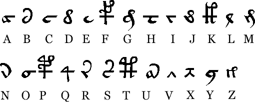
Title: Re: First a math question, then... Post by: Phinnaeus Gage on January 03, 2013, 07:29:26 AM Dafuq dat? FDFY! ;D http://en.wikipedia.org/wiki/Voynich_manuscript In fact, this is what's going to give us the inspiration as to what to name the damn thing. ~Bruno K~ Title: Re: First a math question, then... Post by: sounds on January 03, 2013, 09:33:54 AM Some say the Voynich manuscript is a hoax, and contains no real meaning.
I'm fascinated by your idea, Phinnaeus. When the user gets to the final point, would the item do or reveal anything? If not... what a joke! Oh, and I can second what SgtSpike and myrkul are saying: because GPS confines all coordinates to MSL (Mean Sea Level) + elevation, and elevation is always much smaller than the diameter of the sphere, then we can say elevation is always (approximately) zero. This means a triangle formed by three GPS coordinates is either degenerate (it's a straight line) or, the points and the length from each point will exactly resolve to one "solution." Since elevation is not truly zero, there are actually two solutions if elevation is included in the calculation; but both solutions need to be averaged together to get the best Latitude and Longitude reading for the real solution (that is, use Newton's method to approximate a more accurate solution along the line between the two mathematical solutions). Title: Re: First a math question, then... Post by: Phinnaeus Gage on January 03, 2013, 03:45:18 PM Some say the Voynich manuscript is a hoax, and contains no real meaning. I'm fascinated by your idea, Phinnaeus. When the user gets to the final point, would the item do or reveal anything? If not... what a joke! Oh, and I can second what SgtSpike and myrkul are saying: because GPS confines all coordinates to MSL (Mean Sea Level) + elevation, and elevation is always much smaller than the diameter of the sphere, then we can say elevation is always (approximately) zero. This means a triangle formed by three GPS coordinates is either degenerate (it's a straight line) or, the points and the length from each point will exactly resolve to one "solution." Since elevation is not truly zero, there are actually two solutions if elevation is included in the calculation; but both solutions need to be averaged together to get the best Latitude and Longitude reading for the real solution (that is, use Newton's method to approximate a more accurate solution along the line between the two mathematical solutions). It will be up to the giver of the device and how that person programmed it as to what's at the final destination. The possibilities are endless: the geocaching crowd could find a use for it; lovers could give it to their sole mates, where its only purpose is to read out how far away they are from the location of their first kiss, date, sex, met, etc.; B & M businesses could use it for some creative marketing campaign; among others I've thought of and, given time, a myriad more examples would manifest themselves. Bottomline, let the end users decide its purpose. Putting aside the marketing aspect to create a demand for the device (just had a vision of Atlas when I penned 'device' that time--weird!), what would be paramount is that the device works properly, and the website function seamlessly with little effort on the user's part. I further propose that the device be manufactured in the US as cost efficient as possible, not worrying too much of its final price point, for it's a gift, not a necessity. As a gift, the device should have aesthetic qualities in its design and packaging, albeit it's possibly just a box-like structure. For sake of argument, we'll just safely assume that one coordinated is possible when only three coordinates are inputted. Any bugs regarding this fact can be worked out during the coding stage of the accompanied website. More to come. ~Bruno K~ Title: Re: First a math question, then... Post by: Phinnaeus Gage on January 03, 2013, 03:56:07 PM http://www.afternight.com/runes/a-voynich.gif http://historicmysteries.com/wp-content/uploads/2010/04/Voynich.png
Title: Re: First a math question, then... Post by: myrkul on January 03, 2013, 04:09:26 PM Dafuq dat? FDFY! ;D http://en.wikipedia.org/wiki/Voynich_manuscript In fact, this is what's going to give us the inspiration as to what to name the damn thing. ~Bruno K~ That's pretty trippy. Title: Re: First a math question, then... Post by: Phinnaeus Gage on January 03, 2013, 05:21:54 PM Dafuq dat? FDFY! ;D http://en.wikipedia.org/wiki/Voynich_manuscript In fact, this is what's going to give us the inspiration as to what to name the damn thing. ~Bruno K~ That's pretty trippy. I've coined a name for the device, stemming from the following: http://farm9.staticflickr.com/8219/8342816018_f5719abe84_t.jpg It currently has only one mundane result via Google and is easy to pronounce, coupled with having other attributes. I'm going to purchase the domain name later today. To be clear, the Voynich Manuscript was only used for inspiration in naming the device and gleaning an example symbol. I sure the hell don't desire to be sued by descendants of its author. ~Bruno K~ Title: Re: First a math question, then... Post by: Peter Lambert on January 03, 2013, 10:38:14 PM woah, i just learned something... it results in TWO points IF all 3 known points are in a straight line. and it follows that an infinite number of known points will not reduce this to 1 known point as long as all the known points are in a straight line. gotta have some kind of triangle there for triangulation :D That's what I figured. Allow me to be a little more specific. You are holding a device that reads out that you are X miles away from a specific location. No GPS coordinates are given, with this fact being true for all as I continue with my example. You move to another location of which you know the direction and distance, then reread the device. It now states that you are Y miles from that same specific location. Either from the new location or the original one, you once again relocate to another point, also knowing how far and what direction you traveled. Looking at the device, you now see that you are Z distance from the specific location desired. Given that, can you triangular where the desired specific location is by one result, or is there a second result that also must be checked? Assume the distance is in a straight line as a crow flies. Thanks to all who've answered so far. ~Bruno K~ What you are describing is called "Triangulation", it works to find a point in a plane if the three given points are not in a line. If you have three dimensions you would need a fourth point, as you will get two possible solutions from three points unless the given point is coplanar with the three. You don't have to worry too much over short distances, but for longer distances you might need to know whether the distance follows the surface of the earth or goes through it? Title: Re: First a math question, then... Post by: SgtSpike on January 03, 2013, 10:57:04 PM woah, i just learned something... it results in TWO points IF all 3 known points are in a straight line. and it follows that an infinite number of known points will not reduce this to 1 known point as long as all the known points are in a straight line. gotta have some kind of triangle there for triangulation :D That's what I figured. Allow me to be a little more specific. You are holding a device that reads out that you are X miles away from a specific location. No GPS coordinates are given, with this fact being true for all as I continue with my example. You move to another location of which you know the direction and distance, then reread the device. It now states that you are Y miles from that same specific location. Either from the new location or the original one, you once again relocate to another point, also knowing how far and what direction you traveled. Looking at the device, you now see that you are Z distance from the specific location desired. Given that, can you triangular where the desired specific location is by one result, or is there a second result that also must be checked? Assume the distance is in a straight line as a crow flies. Thanks to all who've answered so far. ~Bruno K~ What you are describing is called "Triangulation", it works to find a point in a plane if the three given points are not in a line. If you have three dimensions you would need a fourth point, as you will get two possible solutions from three points unless the given point is coplanar with the three. You don't have to worry too much over short distances, but for longer distances you might need to know whether the distance follows the surface of the earth or goes through it? Title: Re: First a math question, then... Post by: myrkul on January 03, 2013, 11:19:59 PM woah, i just learned something... it results in TWO points IF all 3 known points are in a straight line. and it follows that an infinite number of known points will not reduce this to 1 known point as long as all the known points are in a straight line. gotta have some kind of triangle there for triangulation :D That's what I figured. Allow me to be a little more specific. You are holding a device that reads out that you are X miles away from a specific location. No GPS coordinates are given, with this fact being true for all as I continue with my example. You move to another location of which you know the direction and distance, then reread the device. It now states that you are Y miles from that same specific location. Either from the new location or the original one, you once again relocate to another point, also knowing how far and what direction you traveled. Looking at the device, you now see that you are Z distance from the specific location desired. Given that, can you triangular where the desired specific location is by one result, or is there a second result that also must be checked? Assume the distance is in a straight line as a crow flies. Thanks to all who've answered so far. ~Bruno K~ What you are describing is called "Triangulation", it works to find a point in a plane if the three given points are not in a line. If you have three dimensions you would need a fourth point, as you will get two possible solutions from three points unless the given point is coplanar with the three. You don't have to worry too much over short distances, but for longer distances you might need to know whether the distance follows the surface of the earth or goes through it? Still not an issue, though, since the other point is either up in the air, or within the earth, and is at the same x,y coordinates anyway. Title: Re: First a math question, then... Post by: SgtSpike on January 03, 2013, 11:25:28 PM woah, i just learned something... it results in TWO points IF all 3 known points are in a straight line. and it follows that an infinite number of known points will not reduce this to 1 known point as long as all the known points are in a straight line. gotta have some kind of triangle there for triangulation :D That's what I figured. Allow me to be a little more specific. You are holding a device that reads out that you are X miles away from a specific location. No GPS coordinates are given, with this fact being true for all as I continue with my example. You move to another location of which you know the direction and distance, then reread the device. It now states that you are Y miles from that same specific location. Either from the new location or the original one, you once again relocate to another point, also knowing how far and what direction you traveled. Looking at the device, you now see that you are Z distance from the specific location desired. Given that, can you triangular where the desired specific location is by one result, or is there a second result that also must be checked? Assume the distance is in a straight line as a crow flies. Thanks to all who've answered so far. ~Bruno K~ What you are describing is called "Triangulation", it works to find a point in a plane if the three given points are not in a line. If you have three dimensions you would need a fourth point, as you will get two possible solutions from three points unless the given point is coplanar with the three. You don't have to worry too much over short distances, but for longer distances you might need to know whether the distance follows the surface of the earth or goes through it? Still not an issue, though, since the other point is either up in the air, or within the earth, and is at the same x,y coordinates anyway. And yes, it would be up in the air or within the earth, but that must be kept in mind when determining which x,y is the proper one. As long as you get the point that isn't in the air or in the ground, you're golden, but how do you determine that mathematically? It must be kept in mind. Title: Re: First a math question, then... Post by: Peter Lambert on January 03, 2013, 11:30:18 PM It's not at the same x,y... And yes, it would be up in the air or within the earth, but that must be kept in mind when determining which x,y is the proper one. As long as you get the point that isn't in the air or in the ground, you're golden, but how do you determine that mathematically? It must be kept in mind. Actually, it would be the same x,y if all three points are in the x,y plane. Title: Re: First a math question, then... Post by: SgtSpike on January 03, 2013, 11:38:13 PM It's not at the same x,y... And yes, it would be up in the air or within the earth, but that must be kept in mind when determining which x,y is the proper one. As long as you get the point that isn't in the air or in the ground, you're golden, but how do you determine that mathematically? It must be kept in mind. Actually, it would be the same x,y if all three points are in the x,y plane. Title: Re: First a math question, then... Post by: myrkul on January 04, 2013, 12:02:57 AM It's not at the same x,y... And yes, it would be up in the air or within the earth, but that must be kept in mind when determining which x,y is the proper one. As long as you get the point that isn't in the air or in the ground, you're golden, but how do you determine that mathematically? It must be kept in mind. Actually, it would be the same x,y if all three points are in the x,y plane. On the scale that GPS operates at, even the Himalayas are only +1 or 2 Z, and just about everything else is effectively 0. Title: Re: First a math question, then... Post by: SgtSpike on January 04, 2013, 12:06:34 AM It's not at the same x,y... And yes, it would be up in the air or within the earth, but that must be kept in mind when determining which x,y is the proper one. As long as you get the point that isn't in the air or in the ground, you're golden, but how do you determine that mathematically? It must be kept in mind. Actually, it would be the same x,y if all three points are in the x,y plane. On the scale that GPS operates at, even the Himalayas are only +1 or 2 Z, and just about everything else is effectively 0. Title: Re: First a math question, then... Post by: myrkul on January 04, 2013, 12:11:10 AM It's not at the same x,y... And yes, it would be up in the air or within the earth, but that must be kept in mind when determining which x,y is the proper one. As long as you get the point that isn't in the air or in the ground, you're golden, but how do you determine that mathematically? It must be kept in mind. Actually, it would be the same x,y if all three points are in the x,y plane. On the scale that GPS operates at, even the Himalayas are only +1 or 2 Z, and just about everything else is effectively 0. Title: Re: First a math question, then... Post by: SgtSpike on January 04, 2013, 12:20:42 AM It's not at the same x,y... And yes, it would be up in the air or within the earth, but that must be kept in mind when determining which x,y is the proper one. As long as you get the point that isn't in the air or in the ground, you're golden, but how do you determine that mathematically? It must be kept in mind. Actually, it would be the same x,y if all three points are in the x,y plane. On the scale that GPS operates at, even the Himalayas are only +1 or 2 Z, and just about everything else is effectively 0. Picture a pole that goes the same distance below ground as it does above ground, and is perfectly straight up and down relative to the earth's surface. You could say that the top of the pole and the bottom of the pole have the same x,y coordinates on the surface of the earth. Now, tilt that pole any direction. The x,y has changed. Even if the tilt is not large, it can have a significant impact on the x,y coordinates, depending on how long it is, what the point of rotation is, etc etc. When you calculate the two potential answers, picture a pole between those two potential answers. The only way the pole would be straight up and down is if the triangle is perfectly parallel to the earth (i.e., you took all three data points at the same elevation). If the triangle rotates along an axis, the pole is then tilted to the same degree. For instance, if the three data points are taken on a 45 degree incline, relative to the potential answer, then one answer would be at the correct x,y,z on the surface of the earth, and the other answer would be x/1.41, y/1.41, somewhere below the surface of the earth. The tilt of the triangle of the three data points collected is what would determine the largeness of the difference between the two points, not the scale of the GPS triangulation. Title: Re: First a math question, then... Post by: myrkul on January 04, 2013, 12:55:30 AM It's not at the same x,y... And yes, it would be up in the air or within the earth, but that must be kept in mind when determining which x,y is the proper one. As long as you get the point that isn't in the air or in the ground, you're golden, but how do you determine that mathematically? It must be kept in mind. Actually, it would be the same x,y if all three points are in the x,y plane. On the scale that GPS operates at, even the Himalayas are only +1 or 2 Z, and just about everything else is effectively 0. Not small. Large. The scale is extremely large. At large scales, small differences don't matter. For instance: Let's say I gave you a box tuned for some point in the continental US. To prove your point, you go to the highest point in Denver, 5,690 feet up, to take your first measurement, and for your second, you go to Death Valley, 282 feet below sea level. For your third measurement, you pick a spot out on the great plains. Over a distance of about 700 miles, the difference in elevation is 5,972 feet. (1.131 miles) Not exactly what I would call "steep." Title: Re: First a math question, then... Post by: Phinnaeus Gage on January 04, 2013, 02:27:27 AM Interesting!: http://en.wikipedia.org/wiki/Global_Positioning_System
Quote The Global Positioning System (GPS) is a space-based satellite navigation system that provides location and time information in all weather conditions, anywhere on or near the Earth where there is an unobstructed line of sight to four or more GPS satellites. Then, why not three? Title: Re: First a math question, then... Post by: myrkul on January 04, 2013, 02:46:28 AM Interesting!: http://en.wikipedia.org/wiki/Global_Positioning_System Quote The Global Positioning System (GPS) is a space-based satellite navigation system that provides location and time information in all weather conditions, anywhere on or near the Earth where there is an unobstructed line of sight to four or more GPS satellites. Then, why not three? Because the reference points (the satellites) have significant elevation distance on the target point (your position). This needs to be accounted for, so that you're not marked as somewhere out in space. Title: Re: First a math question, then... Post by: Phinnaeus Gage on January 04, 2013, 02:52:49 AM Interesting!: http://en.wikipedia.org/wiki/Global_Positioning_System Quote The Global Positioning System (GPS) is a space-based satellite navigation system that provides location and time information in all weather conditions, anywhere on or near the Earth where there is an unobstructed line of sight to four or more GPS satellites. Then, why not three? Because the reference points (the satellites) have significant elevation distance on the target point (your position). This needs to be accounted for, so that you're not marked as somewhere out in space. From the same source: Quote Although four satellites are required for normal operation, fewer apply in special cases. If one variable is already known, a receiver can determine its position using only three satellites. For example, a ship or aircraft may have known elevation. Some GPS receivers may use additional clues or assumptions such as reusing the last known altitude, dead reckoning, inertial navigation, or including information from the vehicle computer, to give a (possibly degraded) position when fewer than four satellites are visible.[39][40][41] I'll assume that that's what you're eluding to, myrkul. ~Bruno K~ Title: Re: First a math question, then... Post by: myrkul on January 04, 2013, 03:03:47 AM Interesting!: http://en.wikipedia.org/wiki/Global_Positioning_System Quote The Global Positioning System (GPS) is a space-based satellite navigation system that provides location and time information in all weather conditions, anywhere on or near the Earth where there is an unobstructed line of sight to four or more GPS satellites. Then, why not three? Because the reference points (the satellites) have significant elevation distance on the target point (your position). This needs to be accounted for, so that you're not marked as somewhere out in space. From the same source: Quote Although four satellites are required for normal operation, fewer apply in special cases. If one variable is already known, a receiver can determine its position using only three satellites. For example, a ship or aircraft may have known elevation. Some GPS receivers may use additional clues or assumptions such as reusing the last known altitude, dead reckoning, inertial navigation, or including information from the vehicle computer, to give a (possibly degraded) position when fewer than four satellites are visible.[39][40][41] I'll assume that that's what you're eluding to, myrkul. ~Bruno K~ Yup, a ship on the ocean, by definition, is at sea level. Thus, any result that does not put it reasonably near to 0 elevation can be thrown out. But using 4 points is only necessary when you don't know the elevation of your target, and it's not coplanar with the reference points. When your reference points are all on the surface of the earth, you can treat them all as coplanar with the target, despite minor elevation differences, because the scales of the X and Y dimensions dwarf that of the Z in all but a very few cases. That's also why I said that the further apart your measurements are, the more accurate your targeting will be. Edit: Oh, and a minor grammatical quibble: elude = dodge; allude = refer ;) Title: Re: First a math question, then... Post by: SgtSpike on January 04, 2013, 07:56:49 AM It's not at the same x,y... And yes, it would be up in the air or within the earth, but that must be kept in mind when determining which x,y is the proper one. As long as you get the point that isn't in the air or in the ground, you're golden, but how do you determine that mathematically? It must be kept in mind. Actually, it would be the same x,y if all three points are in the x,y plane. On the scale that GPS operates at, even the Himalayas are only +1 or 2 Z, and just about everything else is effectively 0. Not small. Large. The scale is extremely large. At large scales, small differences don't matter. For instance: Let's say I gave you a box tuned for some point in the continental US. To prove your point, you go to the highest point in Denver, 5,690 feet up, to take your first measurement, and for your second, you go to Death Valley, 282 feet below sea level. For your third measurement, you pick a spot out on the great plains. Over a distance of about 700 miles, the difference in elevation is 5,972 feet. (1.131 miles) Not exactly what I would call "steep." Title: Re: First a math question, then... Post by: myrkul on January 04, 2013, 03:44:23 PM It's not at the same x,y... And yes, it would be up in the air or within the earth, but that must be kept in mind when determining which x,y is the proper one. As long as you get the point that isn't in the air or in the ground, you're golden, but how do you determine that mathematically? It must be kept in mind. Actually, it would be the same x,y if all three points are in the x,y plane. On the scale that GPS operates at, even the Himalayas are only +1 or 2 Z, and just about everything else is effectively 0. Not small. Large. The scale is extremely large. At large scales, small differences don't matter. For instance: Let's say I gave you a box tuned for some point in the continental US. To prove your point, you go to the highest point in Denver, 5,690 feet up, to take your first measurement, and for your second, you go to Death Valley, 282 feet below sea level. For your third measurement, you pick a spot out on the great plains. Over a distance of about 700 miles, the difference in elevation is 5,972 feet. (1.131 miles) Not exactly what I would call "steep." And have you considered that since it's all pretty much coplanar, that the elevation might be ignored in all the calculations? The distance from Denver to Death Valley might be measured simply by figuring the X/Y distance, and ignoring the Z, producing not a tilted triangle, but one that's perfectly flat along the "surface" and ignores terrain features? That would result in only one target location, wouldn't it? The math to determine distance would be simpler, too. So since it not only results in a more accurate result, but is actually easier to do, don't you think that's how it would be done? Title: Re: First a math question, then... Post by: Peter Lambert on January 04, 2013, 03:48:29 PM And have you considered that since it's all pretty much coplanar, that the elevation might be ignored in all the calculations? The distance from Denver to Death Valley might be measured simply by figuring the X/Y distance, and ignoring the Z, producing not a tilted triangle, but one that's perfectly flat along the "surface" and ignores terrain features? That would result in only one target location, wouldn't it? The math to determine distance would be simpler, too. So since it not only results in a more accurate result, but is actually easier to do, don't you think that's how it would be done? You could test this out - go to a very steep hill, get the distance to the top and then measure it yourself. If the GPS agrees with your measurement, then they take into account z-axis changes. This might depend on how nice of a GPS unit you have? Title: Re: First a math question, then... Post by: SgtSpike on January 04, 2013, 04:19:05 PM It's not at the same x,y... And yes, it would be up in the air or within the earth, but that must be kept in mind when determining which x,y is the proper one. As long as you get the point that isn't in the air or in the ground, you're golden, but how do you determine that mathematically? It must be kept in mind. Actually, it would be the same x,y if all three points are in the x,y plane. On the scale that GPS operates at, even the Himalayas are only +1 or 2 Z, and just about everything else is effectively 0. Not small. Large. The scale is extremely large. At large scales, small differences don't matter. For instance: Let's say I gave you a box tuned for some point in the continental US. To prove your point, you go to the highest point in Denver, 5,690 feet up, to take your first measurement, and for your second, you go to Death Valley, 282 feet below sea level. For your third measurement, you pick a spot out on the great plains. Over a distance of about 700 miles, the difference in elevation is 5,972 feet. (1.131 miles) Not exactly what I would call "steep." And have you considered that since it's all pretty much coplanar, that the elevation might be ignored in all the calculations? The distance from Denver to Death Valley might be measured simply by figuring the X/Y distance, and ignoring the Z, producing not a tilted triangle, but one that's perfectly flat along the "surface" and ignores terrain features? That would result in only one target location, wouldn't it? The math to determine distance would be simpler, too. So since it not only results in a more accurate result, but is actually easier to do, don't you think that's how it would be done? Title: Re: First a math question, then... Post by: myrkul on January 04, 2013, 04:28:39 PM Good point, I hadn't thought of that...! Sometimes, we overthink things, looking for the complicated answer, when all we need is the simple one. I had a call once when I was doing tech support, that the previous techs had replaced several sound cards, and a number of sets of speakers. The problem? The sound was muted. Title: Re: First a math question, then... Post by: SgtSpike on January 04, 2013, 04:35:21 PM Good point, I hadn't thought of that...! Sometimes, we overthink things, looking for the complicated answer, when all we need is the simple one. I had a call once when I was doing tech support, that the previous techs had replaced several sound cards, and a number of sets of speakers. The problem? The sound was muted. |